2004/02 New South Wales loop - Mungo |
|||
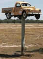 We drove the dirt road south to Pooncarie. The road was bad, bouncing us all
 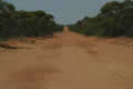 over the place, but we still made good time. Pooncarie itself only has a population of 88, but it has a rather nice cricket field and a joke of a golf course with special penalties for hitting telecom markers and planted trees.
From there it was a reasonable dirt road to Mungo national park.
over the place, but we still made good time. Pooncarie itself only has a population of 88, but it has a rather nice cricket field and a joke of a golf course with special penalties for hitting telecom markers and planted trees.
From there it was a reasonable dirt road to Mungo national park.
Mungo is now famous for its human fossils. The “Mungo woman” bones are thought to be the oldest remains of a human cremation. Mungo was also the place where ancient firepits provided evidence of the periodic shifts in the world’s magnetic fields. Today it’s a group of yet more dried-up lakes, but these have been dry for thousands of years, and the wind has turned the soil from the lake beds into a giant wall of sand dunes known as the Wall of  China.
Mungo was also a sheep operation, given to some soldiers coming back 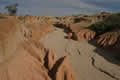 from the First World War. They must have been tough to survive here as long as they did, living underground to avoid the extremes of heat and cold. Their sheep ate every plant in sight and just about wiped out the natural animals. Today there are still feral sheep in the hills, and the kangaroos have come back in force. There may still be hopes for a future business here crossbreeding kangaroos with sheep to get woolly jumpers.
 |
Mungo (13.23) |  |
|---|
We set off to drive the loop around the park. The sheep’s eating of the plants had resulted in 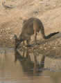 some dramatic erosion, and one end of the Wall was very similar to the North American Badlands, with steep cliffs and deep channels cut into the sand.
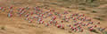
The area behind the dunes was teeming with wildlife. Just about every shrub was shading a kangaroo, and the scrubby trees were full of birds. We stopped at a “tank”, a waterhole dug for the sheep, and there were hundreds of galahs there, wheeling around in the sky. They all came down together on a bank of the tank, and marched towards the water. We t hought this was going to be an event similar to the drowning of the lemmings, but suddenly something spooked them and they all exploded into the sky, only to repeat the whole sequence.
It became obvious that we weren’t going to complete the loop before dark, so we drove to  Vigars Well to see the dunes and watch the sunset. Vigars Well really is a well, as the water table follows the line of the dunes, and there is fresh water partway up the dunes, just a few feet below the sand.
The dunes here are massive, hundreds of feet high. They were also much firmer than our Colorado sand dunes, and it was quite feasible to sprint up them to grab some sunset pictures before dark. Finding my way back down in the dark was more problematic. The drive around the rest of the loop and to the campsite was nerve wracking, dodging roos and rabbits in the dark. It was the first time we’d used the Landcruiser’s huge spotlights in earnest, and they helped a lot.