2010/10 Australia trip - Cape York |
|||
A short way on the other side of the main road is a wetland with very sparse vegetation, obviously nutritionally poor soil  as pitcher plants, the kind that feed on insects, were thriving there.
The aboriginal reserves to the north of us, like many such places, have some strange liquor laws. They only allow visitors to carry specific amounts of products like beer, wine, and premixed spirits, with no mention of anything as simple as a bottle of rum. We didn’t know if or how they enforce the laws, but the fines are enormous. So we found a place to bury our bottle, and took its GPS coordinates, planning to pick  it up on our way back south. Hopefully there won’t be road works going on when we get back there!
We were back on the main drag with all its corrugations for a long time, and then blissfully we had blacktop  for the aboriginal and Islander communities of Injinoo, Bamaga, New Mapoon and Seisia, all pleasant little places, very close together compared to the rest of Cape York. There seemed to be little to see in Injinoo, but Bamaga looked to be the place to go shopping. Seisia is a fishing town on the west coast, the Gulf of Carpentaria. The local kids were splashing around happily in the harbour, totally ignoring all the croc warning signs.
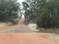
We’d be coming back to the towns later, so we moved on north, still bouncing, and back on a narrower dirt road. We passed the Croc Tent, a local souvenir store, at the turning to Punsand Bay our planned camping spot, and continued on towards Cape York. The road narrowed to a single lane winding through jungle known as the Lockerbie Scrub, a much darker and dense area than we had seen so far. This was the kind of jungle I’d expected to see more of on our way up the Cape. We passed the Pajinka Wilderness resort, now closed and fast being reclaimed by the jungle.
| Cape York area (1.53) |
 |
|---|
And then we were there at the Cape! Or at the beach at least, with a half dozen other trucks and a dozen or so people, all much younger than us. But we weren’t really at the northernmost point yet, as we still had to hike up and over the Cape itself, a big chunk of granite, before we were able to get down to the water.
![]()

I managed to persuade Sandie to ignore worries about crocodiles and sharks and to pose with the sign that said we were at the northernmost point of the Australian continent. In front of us were a couple of islands, York and Eborac. To the west of us was the Arafura Sea and to the east the Coral Sea. A hundred miles north of us across the Torres Strait was the island of Papua and New Guinea.
We were perhaps 600 miles from the Equator so the sun was hot but there was a strong southeaster keeping it cool. The water was warm and inviting, but there was a notice saying that an estuarine crocodile, a saltie, had recently been spotted there.
As we turned around and began walking back towards the parking lot, we were aware that we were heading south and that our trip was half over. However, we planned to stay in the vicinity for a few days of exploring and to take a ferry trip over to the Torres Islands, so we weren’t really heading back yet. With our side trips and detours, we’d covered over 3500 miles from Melbourne to Cape York and taken 20 days.