2018/07 Arctic Part 2 - Canol Road |
|||||
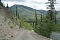 We were taking the Canol Road south to the Alaska Highway. There was a warning sign as we entered to say that maintenance for the year
 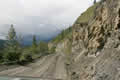 had finished, which I think meant that rock-falls and trees-down were our problem, not the Highways Department’s. It added “Use at your own risk”. The posted speed limit was 25 mph and the road nearly 150 miles long so this would take a while!
 |
Bridge (0.26) |
 |
|---|
This part of the Lapie Canyon had clearly been an engineering challenge. The road was more like a Jeep track and our camper truck is muchwider than our Jeep. Sandie was complaining that she had one wheel scrubbing the cliff and the other waggling in the air. I pointed out that we only needed the inner wheel on the road but my advice didn’t seem to help.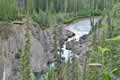
 Eventually the scenery became less rugged as we followed the Lapie River upstream and the road mellowed to logging road standards.
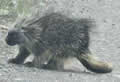
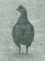
We passed a camper like ours, the only vehicle we saw that afternoon. We also met this porcupine, very casual about getting off the road, and more grouse, some with chicks. There was a rapid stop for a pile of rocks impersonating a moose, but no real ones, even though the habitat looked ideal.
|
Grouse family (1.14) |
 |
|---|
|
Porcupine (0.18) |
 |
|---|
The engine light came on. We were at least a day’s drive from anywhere that might be able to read the error codes, and probably at least a week to get a spare part delivered, so we did the best we could; we ignored the light.
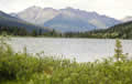 We stopped for a late lunch at the Lapie Lakes surrounded by soggy meadows but with great mountain views in all directions.
.
We were then following Rose Creek downstream and found a noisy campsite at the bottom of a steep slope next to one of its rushing sections. It was a pretty spot but too cold and buggy to sit out.
Thursday July 12th
We had a wet night and it was still raining in the morning but this land was rocky rather than muddy so we had no problem climbing out of our campsite and up to the road. The rest of the Canol Road was very good gravel. We met four or five other vehicles; more traffic at this end of the road, probably for the lakes, boating and fishing.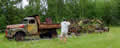
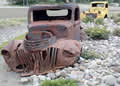 We passed this ancient grader outside the maintenance depot. There were more relic trucks at the road’s exit to the Alaska Highway at Johnson’s Crossing, a resort on the Teslin River.
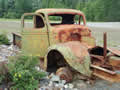
We filled up with diesel and dumped our tanks and then headed east on the Alaska Highway towards Watson Lake.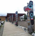 We stopped in Teslin at the Tlingit Heritage Centre to have lunch amongst their totems.
We came to the Cassiar Highway, our chosen route south, but passed it by to make the short round trip into Watson Lake for Internet, water, and shopping. It was a little smoky from the fire but not bad, by BC standards anyway.
We went back to the Cassiar and headed south, soon crossing into British Columbia. We were still a thousand miles north of Hope and about a week’s lazy travel from home. That story will be in Part 3 of this journal.