2006/03 Southwest USA trip (AZ-MN) - Fourth of July Peak |
|||
 March 2006
Dear All,
At the end of Part 2, we were just leaving Organ Pipe Cactus national monument and beginning our journey home. Our most direct route would be just over two thousand miles but we would travel further than that, as the direct route would take us through the mountains to the north and we wanted to stay in the warmer plains to the south. Our expectation was that we’d take our time and stop at interesting places while traveling east back to Texas and then make a giant leap north to avoid having to camp in the snow. As it turned out, the weather was good and we were able to take our time on the journey north.
Tuesday February 14th
From Organ Pipe Cactus park we headed north through Why towards the town of Ajo. When we passed the massive tailings dumps of the Ajo copper mine, we didn’t expect the town to be attractive, but it had a beautiful Spanish-style town square and church. We took advantage of their library to catch up on our e-mail, and their Laundromat to wash just about everything we had. Just like the park, the Laundromat was full of old people too! They were all from surrounding campgrounds and trailer parks, down in Arizona for the winter.
North of Ajo the road passes through the Barry Goldwater Air Force Range. We’d been seeing planes and hearing explosions the previous day. Luckily this wasn’t their day for practicing car bombing and we made it to Gila Bend in one piece.
From there we were following directions from one of Sandie’s mining books: 30 miles north through irrigated farmland to the west of the Gila River and then another 30 miles west into the desert and mountains with just cattle grids and a railroad crossing for markers. We’d crossed the river on an ancient single-lane metal bridge that had seen better days. The dam just upstream of the bridge looked to have failed so the river must get very large at times. 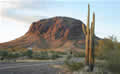
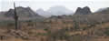 The road west was quite good considering that we couldn’t see any reasons for building it. Our assumption was that there must be tracks off it that led to ranches, but they weren’t obvious and we saw no buildings. We came to Fourth of July Peak and set up camp. This was supposed to be a good spot for banded agates, but we found little despite climbing up to some mine workings high on the mountain. What we did find was some spectacular scenery, great craggy mountains, and sweeping valleys, mostly in their natural state, with saguaros and chollas dotting the landscape. We sat and watched the sun go down, lighting a few clouds in the west and turning the east into a
 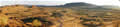 blaze of pink. We saw a couple of trucks far off on the road, but otherwise we had all this scenery to ourselves. (We’re the white dot in the
  centre of the picture here and also on the right side of the front cover.)
Wednesday February 15th
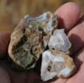
I found a few agates on an early morning walk, but nothing really nice, so we drove around to the east face of the mountain and started looking there. There were lots of nice pale blue agates, but only a few large ones. We collected a lot of small pieces, but needed to be moving on.