2006/01 Southwest USA trip (MN-TX) - Papalotito Colorado, Big Bend Ranch |
|||
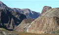 The drive west is just gorgeous. The road hugs the river for a while, winding its way along the edge of the
 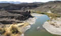 mountains, and there are lots of places with great views of the river. For some reason, water in the desert always seems more magical. I’ve included a number of pictures here as this is really a beautiful drive. The piece of road in the picture is known as “The Hill”.
We stopped to hike the stream bed down through Closed Canyon. This is a slot canyon, rather like those in the McDonnell 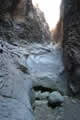 Mountains near Alice Springs. It has red and orange cliffs towering over a tiny stream bed. As the stream runs downhill it gets narrower and steeper, with bigger and bigger pour-offs. Sandie quit the hike when the pour-offs got too high to negotiate. I carried on for a while, but had to take off my camera belt to climb down the pour-offs.
 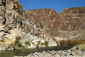 Eventually I had to quit too when the last pour-off dropped off into a pool of water and I wasn’t ready for any swimming, nor was I sure I could have climbed out of the pool!
We had one more beautiful stop at the Colorado Canyon. This has nothing to do with the famous Colorado River. The river was still the Rio Grande. “Colorado” is Spanish for “red” so it shows up in lots of place names.
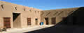 The park ends at Fort Leaton and we stopped there at park HQ to pick up a permit for two days’ entry to the
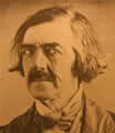 wilderness area and to get the code for the road’s gate. The headquarters are in an imposing building, constructed in the 1800s by an American scalp hunter who’d been hired by the Mexicans to kill Indians. The Spaniards built forts nearby back in the 1680s. Fort Leaton, though, was never officially a military fort but rather the premises for a business that had so many enemies that it had to be fortified. The next few years of bloody history included debt, murder, and revenge. The pretty guy in the picture was one of the players. After all these years it is still an impressive building. The ranger on duty seemed a bit lonely and we ended up talking with him for an hour or so. I noticed that the visitor’s book had about one signature a day.
 The road into the interior was quite good gravel, though it became a bit more rugged once we turned into the
 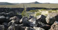 park. This was more desert scenery with weird contorted mountain shapes on the horizon. The park is still an operational ranch with about 150 head of cattle. We met a small band of longhorns on the way in. We also stopped to look at a stone corral, a remnant of earlier days. I set out to walk to it and eventually realized that it was a lot bigger than it looked and consequently much further away. The thing has six foot high walls with three rows of rocks, so about three foot thick. I guess it takes a lot to keep longhorns corralled!
We also saw mule deer, quail and rabbits on the way in. We stopped to camp at end of a rough track at Papalotito Colorado, a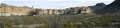 small hill on a plain surrounded by imposed shapes of mountains. We had a small windmill down below us, used for pumping water up for the cattle, and that’s what papalotito means, “little windmill”. We settled down to watch a great sunset, only to have some yahoo in a jet plane draw a straight line contrail right across it. He was probably our nearest neighbour.
The wind was howling outside and it promised to be a noisy night.
small hill on a plain surrounded by imposed shapes of mountains. We had a small windmill down below us, used for pumping water up for the cattle, and that’s what papalotito means, “little windmill”. We settled down to watch a great sunset, only to have some yahoo in a jet plane draw a straight line contrail right across it. He was probably our nearest neighbour.
The wind was howling outside and it promised to be a noisy night.
Saturday January 21st
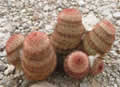
We woke to a cold, blustery morning, but Sandie still ventured outside to go visit the groups of little cacti around our campsite.