2006/01 Southwest USA trip (MN-TX) - Saint Elena Canyon |
|||
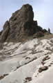 We bounced back down the River Road track to Castolon. This area has really strange scenery, great mountains of dark volcanic tock and low hills of almost white volcanic ash, called tufa or tuff, with dashes of red rock in places.
 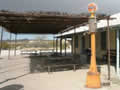 Castolon is a remnant of greater days, with old adobe buildings and a single store selling souvenirs and a little food.
From there we went to the park’s western corner, the Saint Elena Canyon, where the Rio Grande is squeezed between 1500 foot-high cliffs. In places the canyon is only 30 foot wide, so the immigrants could jump into the USA at this point, albeit with a fair amount of bodily injury. A sign there warns Americans of a $5000 fine for going into Mexico and coming back into USA but it’s hard to see how anyone could 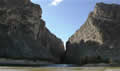 do it!
The limestone cliffs are a mass of fossils, mainly shells and leaves.
do it!
The limestone cliffs are a mass of fossils, mainly shells and leaves.
We hiked up the canyon through a mass of greenery, plants that can only grow here, and a few flowering 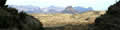 plants that we didn’t recognize. There was even a cottonwood that looked to be in leaf, very strange for January. The trail ended at the canyon’s narrowest point and we didn’t feel like wading around the cliff to see what was there.
On the way back we met the Germans again! Amazing how that happens on these trips. We were out of energy and daylight, so we drove back to our campsite at Black Dike. It was still windy with the sand still flying, so no evening walks this time.
Tuesday January 17th
Tuesday was to be our last day in the park, unless we wanted to spend out for another 7-day permit. We were headed for The Woodward Ranch, a couple of hours north of the park. We still had lots of the park to see, but we decided to leave it for another trip. Next time we’ll get in for nothing on my “Golden Age” pass.
It was a perfectly clear morning, not a cloud in the sky, no wind, and just a smidgeon above freezing.