Sunday October 2nd
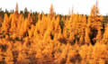 We met some road construction
early on Sunday. In this part of the world they don't waste money on
flagmen or traffic lights. Anyone who comes along just has to thread
through the mud and construction vehicles and try not to get stuck,
or bulldozed, or dumped on. It was a wet and windy drive, but still
very scenic with rivers, lakes, and swamps. The trees were mainly
golden tamaracks with a bright red undergrowth of blueberry bushes.
We met some road construction
early on Sunday. In this part of the world they don't waste money on
flagmen or traffic lights. Anyone who comes along just has to thread
through the mud and construction vehicles and try not to get stuck,
or bulldozed, or dumped on. It was a wet and windy drive, but still
very scenic with rivers, lakes, and swamps. The trees were mainly
golden tamaracks with a bright red undergrowth of blueberry bushes.
We had timed our return trip so
that we could be in Labrador City early on Monday morning to fill up
with propane, but that morning the propane had come back at full
pressure. Very odd, but we were a lot happier! We did some shopping
that afternoon in Labrador City, and then looked for a campsite. We
found one just outside town at the end of a muddy track overlooking a
lake. It was a scruffy spot, probably part of the local summer party
scene, and it also overlooked the QNSL railroad track, so it wasn't
too peaceful that evening with all the railroad maintenance vehicles
coming back. We must have been closer to the iron mine too as we
could hear machinery clanking as well as the foghorn noise.
Monday October 3rd
The day started damp and soon
became wet. We had a slow start as we expected to have to stay around
until 2pm for the library to open and give us access to the Internet.
The propane guys had no clue as to why the propane had stopped and
then started again. It sounded to them like a regulator freeze-up but
it hadn't been cold enough for that. It looked like we'd used about
half the tank and everything was now working again.
We went back to the visitor
centre to fill up from their water supply and to shop for some
souvenirs of Labrador. We also found we could access the Internet
there for a small fee. While we were there Sandie asked why the maps
of Labrador and Quebec don't match. We'd noticed that Labrador showed
part of the border as a straight line along the 52nd Parallel and
Quebec showed it as a very wiggly line which looked like it was the
watershed boundary for all the rivers flowing south into the St
Lawrence. They hand out both maps there and the lady got them out and
admitted "Oh, I'd never noticed." We looked it up on the
Internet and, sure enough, there was a redrawing of the boundaries
back in 1927 which Quebec has never accepted. Nobody lives in that
area so it probably won't be settled until one of the provinces wants
to use the hydro power in those rivers.Fortified by Tim Horton's
chili and donut combo, we set off 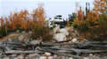 retracing our steps, west to
Fermont and south down the 389 towards Baie Comeau. I wanted to get
to a good campsite I'd spotted on our way north. It was on the beach
at Lake Manicouagan, the meteor crater. The weather had cleared but
the road was just as bad as we remembered until we reached the
blacktop just before Gagnon, the disappeared town. From Gagnon it was
good fast gravel and the drive became a race against the light
through a corridor of reds and golds.
retracing our steps, west to
Fermont and south down the 389 towards Baie Comeau. I wanted to get
to a good campsite I'd spotted on our way north. It was on the beach
at Lake Manicouagan, the meteor crater. The weather had cleared but
the road was just as bad as we remembered until we reached the
blacktop just before Gagnon, the disappeared town. From Gagnon it was
good fast gravel and the drive became a race against the light
through a corridor of reds and golds.
We finally reached the road down
to the lake. There were a few trucks with boat trailers there but
their owners were out on the lake in their boats, so we had the beach
to ourselves, including the site I'd been aiming for. We just had
time to set up and watch the sunset fade across the lake.