The road was mostly good, smooth
gravel, so we made good time. The scenery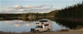 was changing: fewer lakes
on this section, but a number of rivers. About 70 miles out we found
a lake to camp by, a perfect mirror for the trees surrounding it, one
of those dream campsites. It was warm enough to cook outside, an
was changing: fewer lakes
on this section, but a number of rivers. About 70 miles out we found
a lake to camp by, a perfect mirror for the trees surrounding it, one
of those dream campsites. It was warm enough to cook outside, an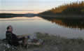 d
there was enough wood lying around for a good fire. By sunset we had
a cloudless sky, and the likelihood of a hard frost by morning.
d
there was enough wood lying around for a good fire. By sunset we had
a cloudless sky, and the likelihood of a hard frost by morning.
ThursdaySeptember 29th
 We had no frost, as it turned wet
and windy in the early
We had no frost, as it turned wet
and windy in the early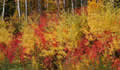 hours. The road became hilly as we were
dropping down amidst mountains, from 2000 ft at Churchill Falls
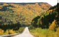
towards Goose Bay at sea level. The colours were becoming more
dramatic, with reds now from the maples and yellows from the birches.
We had moved from granite mountains into sandy hills. We took a side
road, and bounced
hours. The road became hilly as we were
dropping down amidst mountains, from 2000 ft at Churchill Falls
towards Goose Bay at sea level. The colours were becoming more
dramatic, with reds now from the maples and yellows from the birches.
We had moved from granite mountains into sandy hills. We took a side
road, and bounced 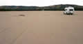 along the rocks down to the Gull Island Project.
This turned out to be acres of sand, a desert below the mountains. We
found out later that this was an exploration effort by the power
company project years ago, but it had all been shut down and removed,
leaving just the sand.
along the rocks down to the Gull Island Project.
This turned out to be acres of sand, a desert below the mountains. We
found out later that this was an exploration effort by the power
company project years ago, but it had all been shut down and removed,
leaving just the sand.
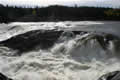 Another side road took us to
Muskrat Falls on the Churchill River. Although the river is diverted
through the power station, the water does end up back in the river
and downstream from Churchill Falls the river is enormous. It is
constricted at Muskrat Falls between granite walls and it thunders
over the 50 foot drop. We enjoyed the opportunity to see this, as the
falls may be part of a future hydro project and they may disappear
behind a concrete dam.
Another side road took us to
Muskrat Falls on the Churchill River. Although the river is diverted
through the power station, the water does end up back in the river
and downstream from Churchill Falls the river is enormous. It is
constricted at Muskrat Falls between granite walls and it thunders
over the 50 foot drop. We enjoyed the opportunity to see this, as the
falls may be part of a future hydro project and they may disappear
behind a concrete dam.